Adım Adım Amasya

The Princes' Route · Stop 14

Kızlar Sarayı

The Maidens' Palace had two gates, women's and men's quarters, a garden, two bathhouses and a kitchen. It is no longer standing — but in the ground beneath it lie two thousand five hundred years.

Late Iron Age – Ottoman Inside the Enderun Kalesi Excavated since 2009
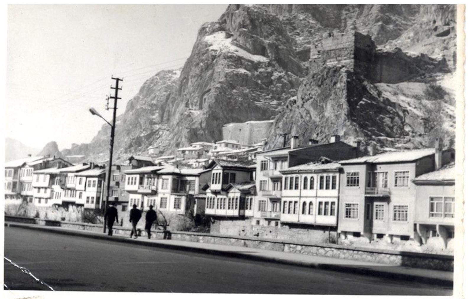
The mansions of İçerişehir in the winter of 1970; the rock slope and castle walls behind
Winter 1970: the Kızlar Sarayı and the mansions of İçerişehir. Sıtkı Karadağ Archive.

📜 What do the documents say?

The Kızlar Sarayı stood inside the Enderun Kalesi. The Enderun Kalesi is an inner castle; in former times it was called Batn-ı Amasya, and because it was near the river it was called the Lower Castle (Aşağı Kale). It lay between the Helkis and Sabiküddin neighbourhoods, the Yeşilırmak and Harşena Castle.1

The palace had two gates, women's and men's quarters (haremlik-selamlık), a garden, two bathhouses and a kitchen.1

One of the gates of the Enderun Kalesi opened onto the Helkis neighbourhood, the other in front of the Alçak Bridge. This gate was pulled down during the governorship of Ziya Paşa (d. 1880).1

Why is it no longer standing? The Enderun Kalesi was ruined by many earthquakes at various dates. Amasya's loss of its status as a princes' province, and the economic crisis the state was in, also prevented the money needed to repair the ancient buildings from being set aside.1

Six layers lie beneath your feet

The stratification revealed by the excavations at Harşena Castle and the Kızlar Sarayı. The newest at the top, the oldest at the bottom.2

about two thousand five hundred years

What has the excavation found?

Excavations have been carried out at the Kızlar Sarayı site since 2009, under the direction of Professor E. Emine Naza-Dönmez.2 The 2011 season was carried out to the north of a bathhouse dated to the 14th century.3

One of the walls uncovered in the excavation does not join the other but continues across it. This points to building phases of different periods3 — that is, in the same place, walls built one on top of another in different centuries.

Why is it called “Kızlar Sarayı”?

No record explaining the origin of the name was found in this project's source archive. That the palace had women's and men's quarters (haremlik-selamlık) is documented;1 it seems plausible that the name comes from this — but this is an inference, not a record, and it is not presented on this page as information. If a definite source is found, it will be added here.

While you are there, look for

Key facts

Where
Inside the Enderun Kalesi (Inner Castle / Lower Castle / Batn-ı Amasya)1
Parts
Two gates, women's and men's quarters, garden, two bathhouses, kitchen1
Cultural layers
5th century BC – 19th century AD, six periods2
Excavation director
Prof. E. Emine Naza-Dönmez, Istanbul University — since 20092, 3
In the book
No separate section — this page was written from the source archive
Coordinates
40.653199, 35.830818 — verified against OpenStreetMap

📍 Open on the map

Sources

This monument has no separate section in the book Kültürel Miras Boyutuyla Amasya. The information on this page was compiled directly from the source archive. Titles are given in their original Turkish so that they can be found; quotations from them are our translations.

  1. Önder Duman – İbrahim Serbestoğlu, Türklerde Çevre ve Şehircilik: Medeniyetimizi Yaşatan İller — Amasya, C. II (Ankara: Çevre, Şehircilik ve İklim Değişikliği Bakanlığı, 2023), 32. — “The Enderun Kalesi, an inner castle called Batn-ı Amasya in former times, lay between the Helkis and Sabiküddin neighbourhoods, the Yeşilırmak and Harşena Castle.”
  2. Amasya Harşena Dağı ve Pontus Kral Kaya Mezarları Alan Yönetim Planı ve UNESCO Dünya Mirası Başvuru Dosyası (Amasya: Amasya Belediyesi, 2022), 22. — The table of the strata revealed by the excavations at Harşena Castle and the Kızlar Sarayı.
  3. E. Emine Naza-Dönmez, “Amasya-Harşena Kalesi ve Kızlar Sarayı Kazısı 2011 Dönemi Çalışmaları”, 34. Kazı Sonuçları Toplantısı, C. III (Çorum: Kültür ve Turizm Bakanlığı, 2013), 427-436, 427. — “Work was begun to the north of the bathhouse dated to the 14th century, in two grid squares designated C 2 and E 3.”